The Advantage Of Professionally Mapped Golf GPS Apps Compared To Satellite Images
Between the high cost of clubs, green fees, balls and any other golf related device or apparel, both avid and casual golfers spend enough money to improve their game and enjoy this great game of golf. Golfers who have embraced the advantage of mobile GPS apps should never settle for anything but professionally mapped GPS apps, free of charge. A closer look reveals the material difference in quality between apps that utilize aerial, Google maps based images, and apps that are professionally mapped.
Aerial Imagery Golf GPS Apps
Here is an example of what some other apps on the market provide the golfer:
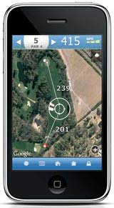
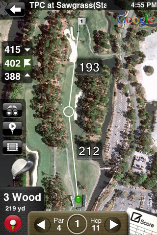
As you can see, the Apps above are satellite images of the golf course. These images can be very muddled, show more than one hole, difficult to identify hazards, and sometimes even difficult for the user to determine which hole is being played. What’s worse, is if it’s a desert course the image could be taken in the summer when the grass is dead. Or if it’s a northern course, you may be looking at a snow-covered image! Further, many apps like these on the market also have no ability to pinpoint specific distances nor provide detailed green yardages. This all leads to a terrible user experience. Worst of all, many apps in the market have the audacity to charge you for this unsatisfactory product.
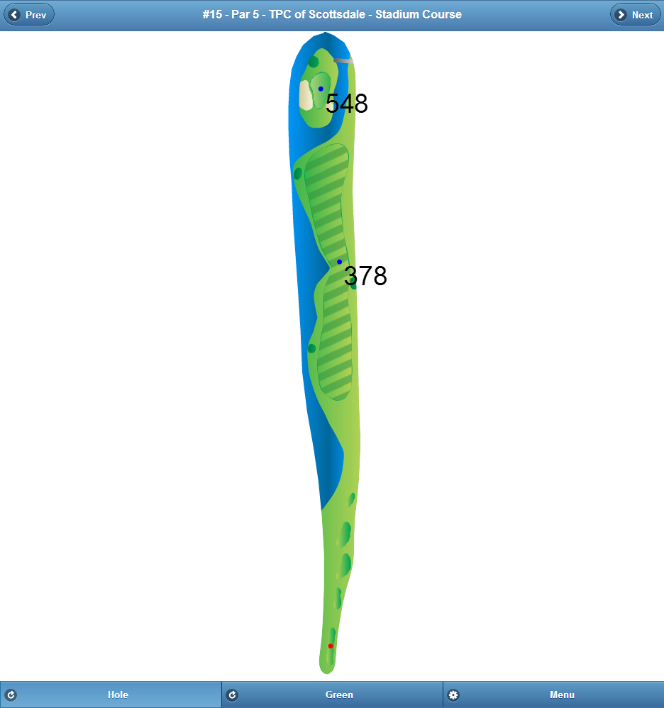
Professionally Mapped Golf GPS Apps
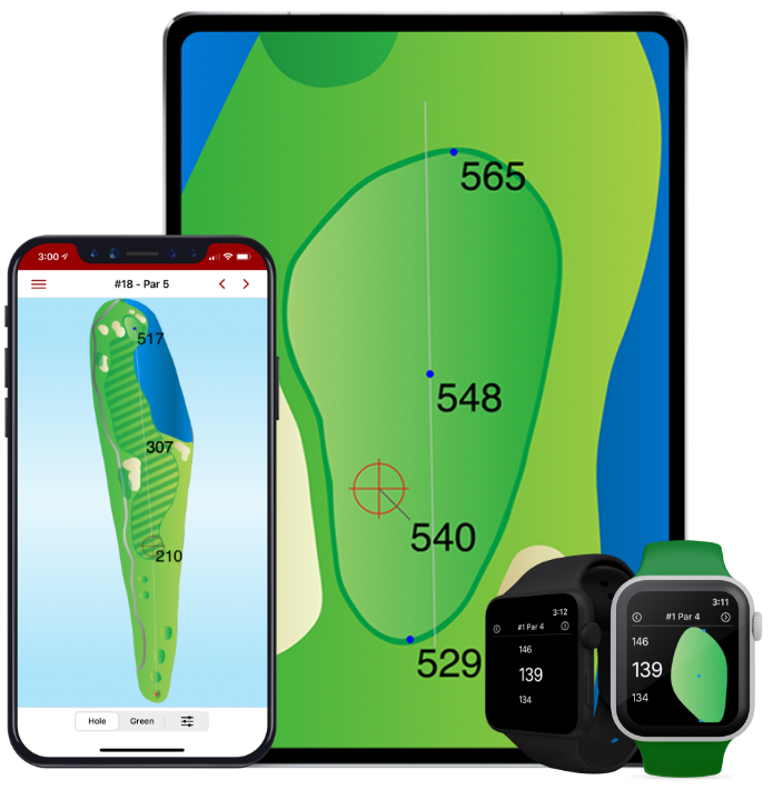
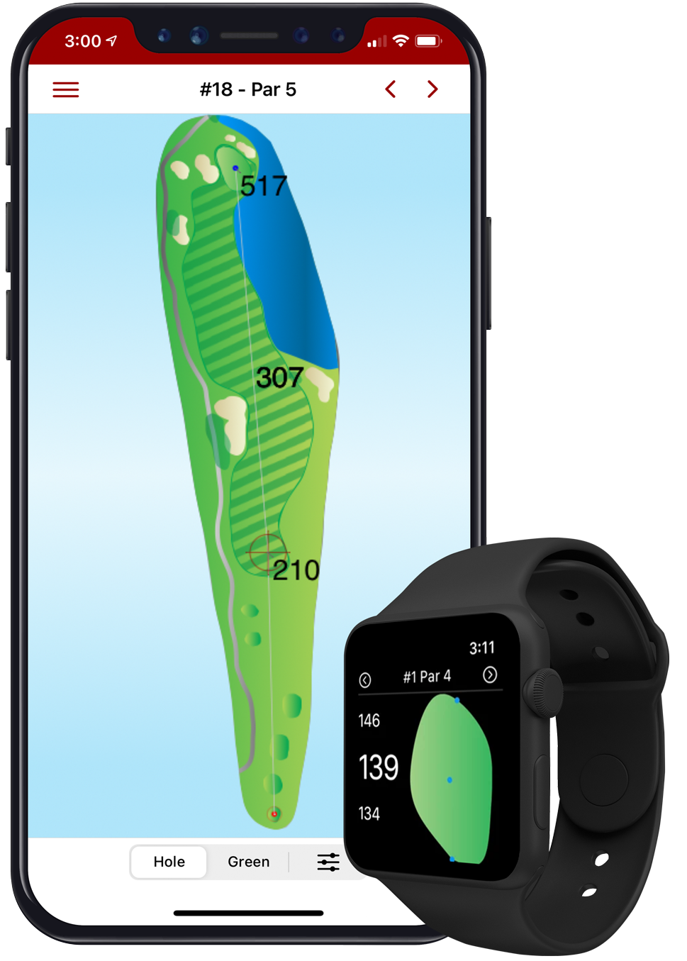
Conversely, below is an example of a hole that has been professionally mapped by Birdie Apps:
Professionally Mapped Golf GPS App – Hole View
Professionaly Mapped Golf GPS App – Green View
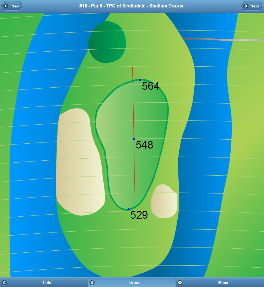
As shown above, the difference is striking. In the professionally mapped image, the hole layout is well defined, there is clear identification of hazards, and the golfer is provided with ultra sharp images. Birdie Apps’ free Golf GPS App even gives the ability for golfers to point to any distance on the map for an immediate & accurate yardage. Further, Birdie Apps provides golfers with a detailed Green View and a helpful “approach line.” Cliick here to learn more about the Line of Approach.
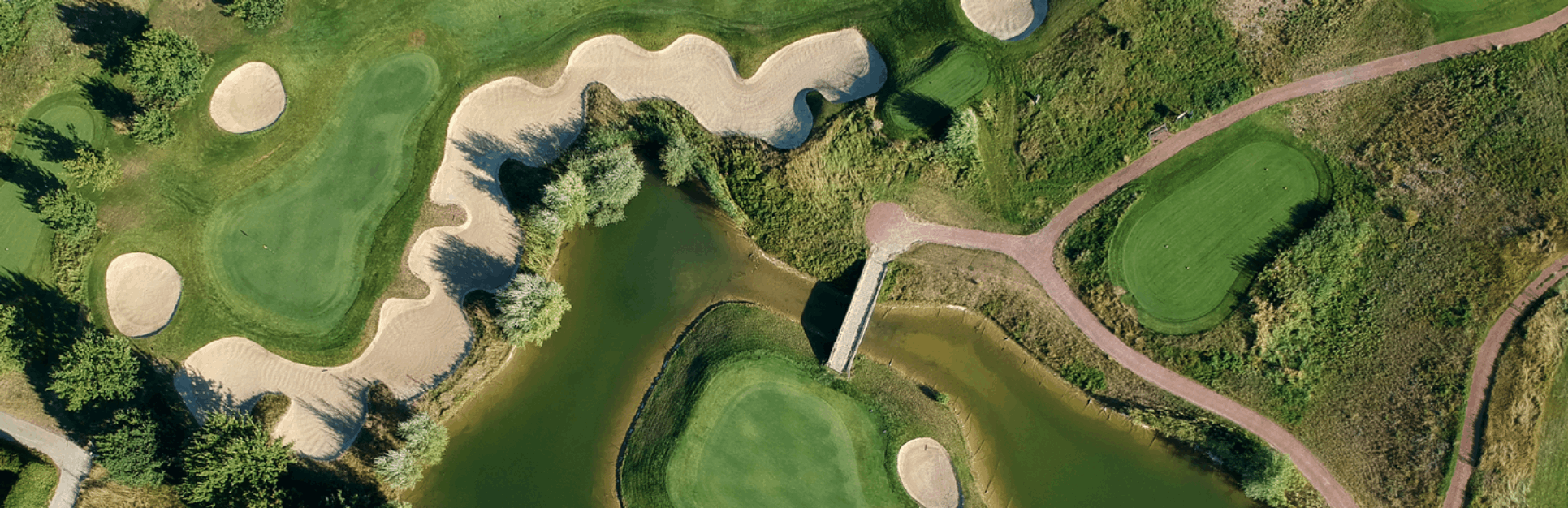
Water hazards can be especially difficult to view on satellite based images. Any golf gps app should clearly identify a water hazard, which isn’t the case with many apps on the market. For example, do you clearly see the water hazard on the hole imaged below?
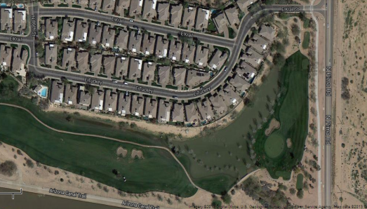
In case you can’t make it out, just below the houses that is a large lake between the two golf holes. The reality is water usually isn’t blue and can take on shades of black, grey or dark green which make identification quite challenging. Without professionally mapped images, you can’t trust your GPS app to define this critical information. A golfer would become quite frustrated hitting their ball into water they didn’t even realize existed. Quality, professionally mapped GPS apps provide clear images of what golfers are looking for most. Birdie Apps provides this level of detail completely free.